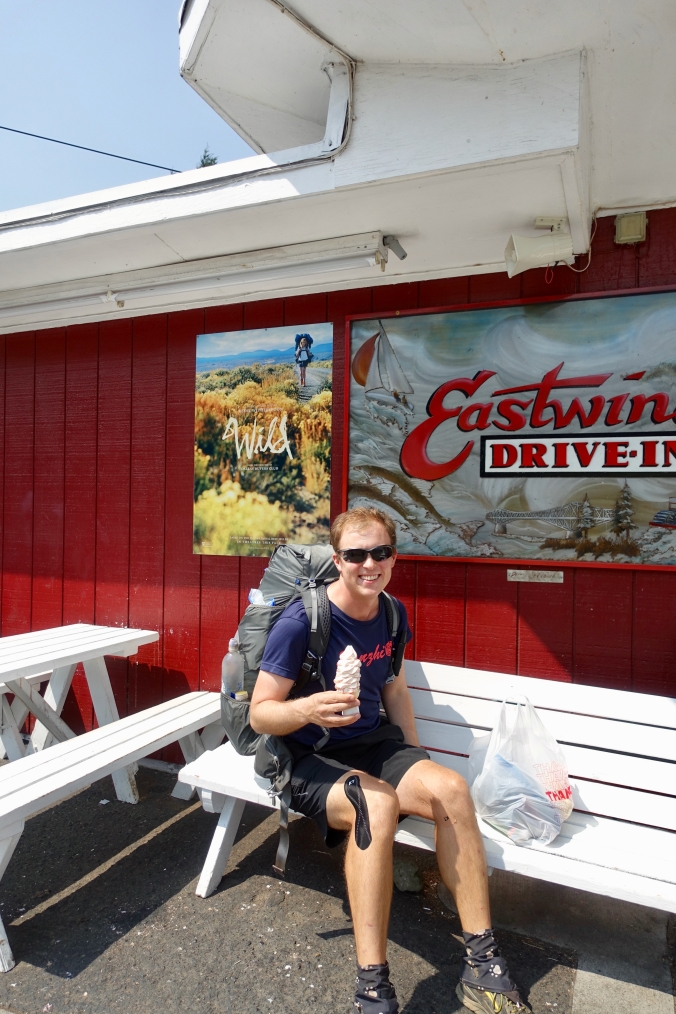
Day 123: Sunrise and drones!

**We’re making a push to finish recording our memories from our 2017 PCT adventure.  This post is from my collection of fully-written and half-written blog posts that are still waiting to see the light of day (along with a few days with just mileage notations and pictures… and may remain that way).**

August 18, 2017

Total daily miles: 25.6 miles
Total PCT miles: 1970.4
Start: mile 2351.7
End: Stirrup Creek (mile 2377.3)
Total elevation gain/loss:5314/6749.3 ft

The day in pictures and random thoughts:

DSC04128

The sunrise was amazing this morning.  Normally we wake up, pack up, and get walking as quickly as possible.  Today, I couldn’t help but take a moment to go out to the dirt road next to our camp site and take in the view.  Pictures don’t do it justice.

LRG_DSC04130

DSC04132

A lovely bit of ridge line walking.

Continue reading

Day 122: Another Fire?

August 17, 2017

Total daily miles: 26.4 miles
Total PCT miles: 1944.8
Start: mile 2325.3
End: mile 2351.7
Total elevation gain/loss: 3448.5/4677.5 ft

When we woke up this morning, the impressive views that had surrounded us when we went to sleep had disappeared. We were now in the clouds. The trail was barely visible in the distance as it wrapped around the mountain. Unsurprisingly, it was also cold. I set off once again wearing my rain jacket, beanie, buff, and even gloves to start the day.

DSC04111

Fog City Trail — aptly named and a reminder of home (San Francisco’s nickname is Fog City).

DSC04112

Continue reading

Day 121: Mt. Rainier views to Chinook Pass

**We’re making a push to finish recording our memories from our 2017 PCT adventure.  This post is from my collection of fully-written and half-written blog posts that are still waiting to see the light of day (along with a few days with just mileage notations and pictures… and may remain that way).**

August 16, 2017

Total daily miles: 25.8 miles
Total PCT miles: 1918.4
Start: Pipe Lake (mile 2299.5)
End: mile 2325.3
Total elevation gain/loss: 4822.2/3874.3 ft

The strain of hiking 1900 miles at a recent pace of 25 miles a day seems to be catching up with my body. By 9pm last night, I was completely spent and practically asleep. When my alarm went off at 5:15, it seemed way too early to even think about getting up. It’s as though my body is now protesting the daily abuse it gets and demanding more rest in return. I guess the evenings of reading my kindle until 10pm have now passed.

DSC04077

If only we were at 2300 miles!

DSC04080

Blueberry pop tart versus blueberries…

Continue reading

Day 120: A Quick Pass Through White Pass

**We’re back!!  It’s the one-year anniversary of our reaching the Northern terminus (spoiler alert) and it turns out that this post has been hanging out in my drafts folder for months now.  It’s honestly been such a gift to have these posts to return to whenever I want to re-live a moment on the trail (which is more frequent than I’d like to admit); I don’t want the record of our memories to remain incomplete!  And, it turns out that I have a collection of fully-written and half-written blog posts that are still waiting to see the light of day (along with a few days with just mileage notations and pictures… and may remain that way).  I guess that it’s better late than never to finish this up!**

August 15, 2017

Total daily miles: 21 miles (19.8 PCT + 1.2 to/from White Pass)

Total PCT miles: 1892.6

Start: Lutz Lake (mile 2279.7)

End: Pipe Lake (mile 2299.5)

Total elevation gain/loss: 3508.2/3385.8 ft

We only had 12.5 miles to hike this morning before reaching While Pass.  Normally we plan to meet up at some point in the 6-8 mile range, but the call of real food and cold drinks was strong so we decided to hike straight through to “town.”

It turned out that we weren’t the only ones camped at Lutz Lake last night, a saw another tent as we turned the corner around the lake this morning.  Still amazing that there weren’t more people around!

The trail this morning did not disappoint.  The vegetation has really opened up.  It’s not like there are no trees anymore, but all of a sudden we’re back to getting views again!  We were treated to great views of Mt. Rainier because the trail took us along a ridge line for a while.  After barely having seen Mt. Hood due to smoke and rain, it was nice to get a clear view of Mt. Rainier.  Even after the trail left the ridge line it continued to hug along the side of the mountain instead of tucking itself away in the trees.  I’m definitely loving Washington these last couple of days!

DSC04067

This kind of terrain makes for much better views than a forest.

DSC04061

Mt. Rainier and around.

Continue reading

Day 119: On Knife’s Edge

August 14, 2017

Total daily miles: 26.5 miles

Total PCT miles: 1872.8
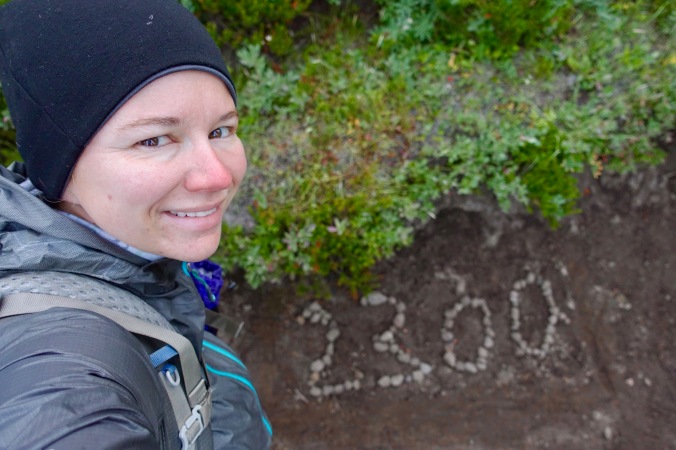
Start: mile 2253.3

End: Lutz Lake (mile 2279.7)

Total elevation gain/loss: 5125/5160.1 ft

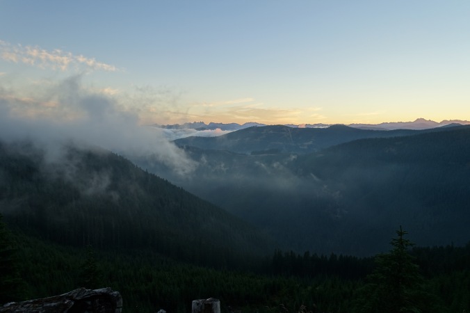
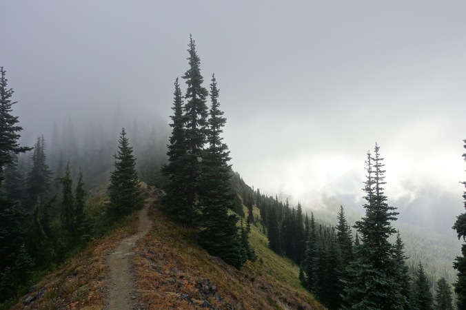
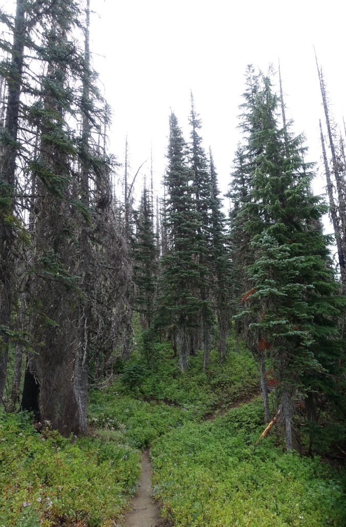
It was so cold this morning!  It’s been a long time since I put on both my puffy and my rain jacket as I got ready in the morning, but today was one of those days.  Even more unusual for me, I spent a good chunk of my morning wearing my beanie and rain jacket for additional warmth as I hiked through the tree cover.  The morning started with a heavy mist that shrouded the trees before the fog finally lifted.  I crossed my fingers that we’d be in for a beautiful day.

DSC04019

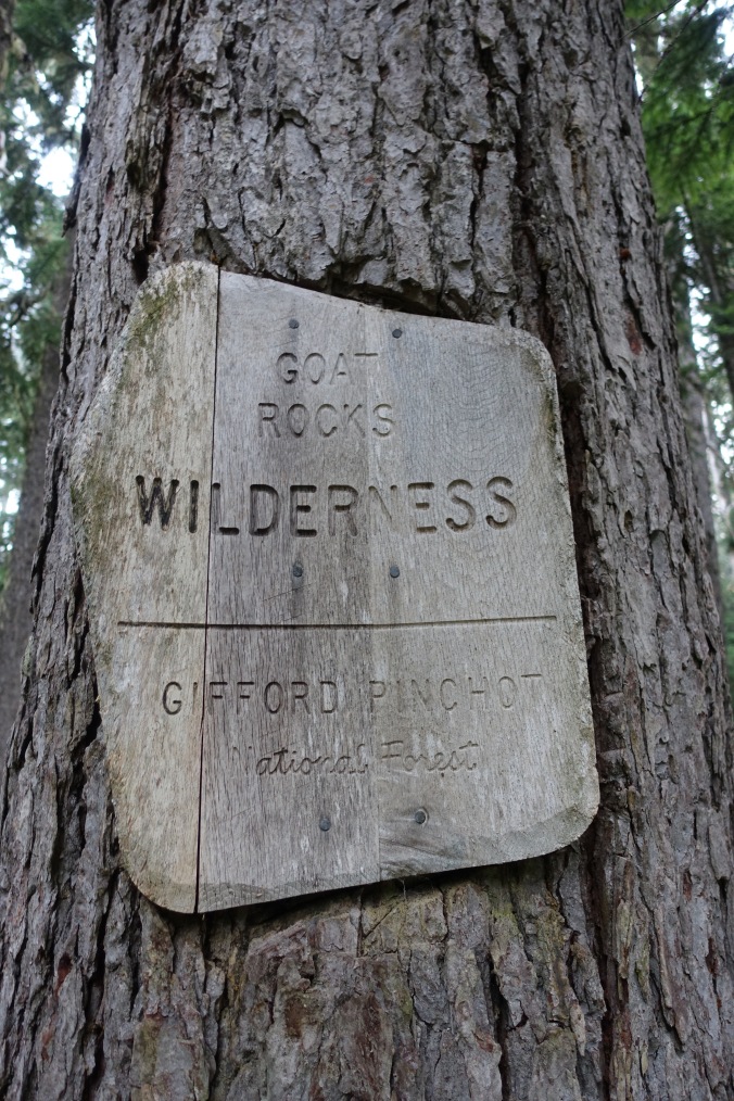
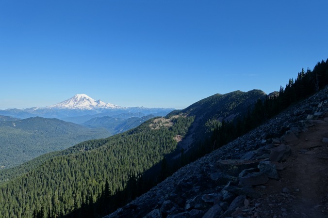
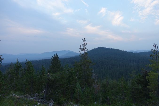
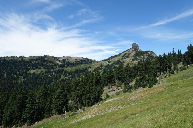
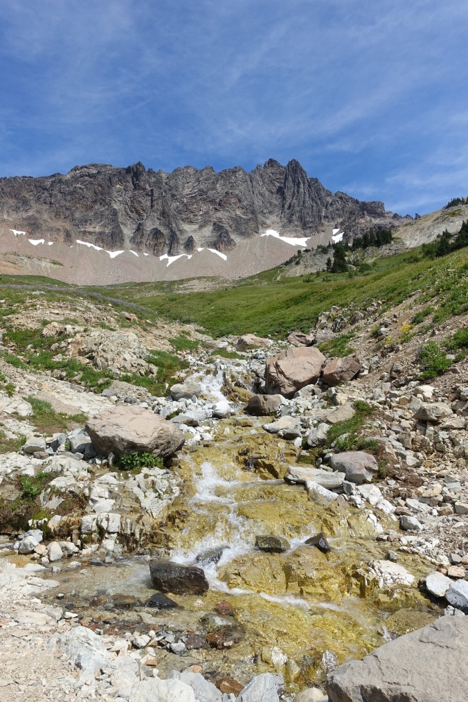
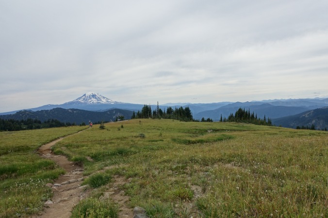
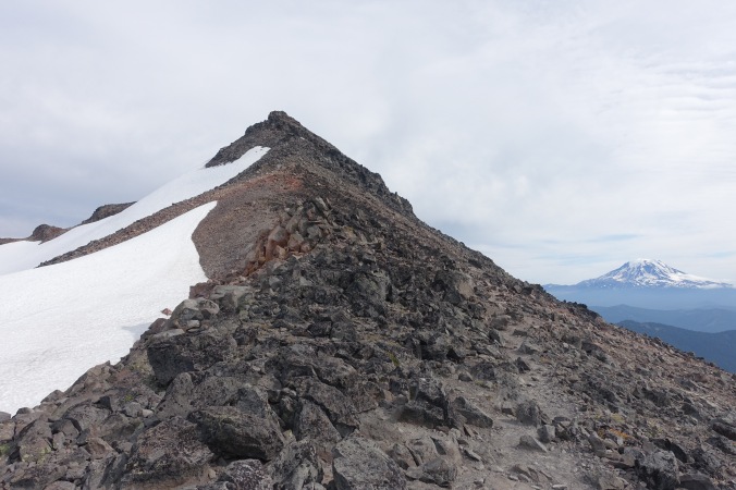
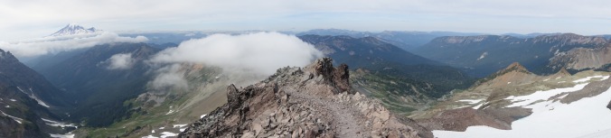
So this is where Goat Rocks Wilderness is!

DSC04020

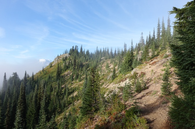
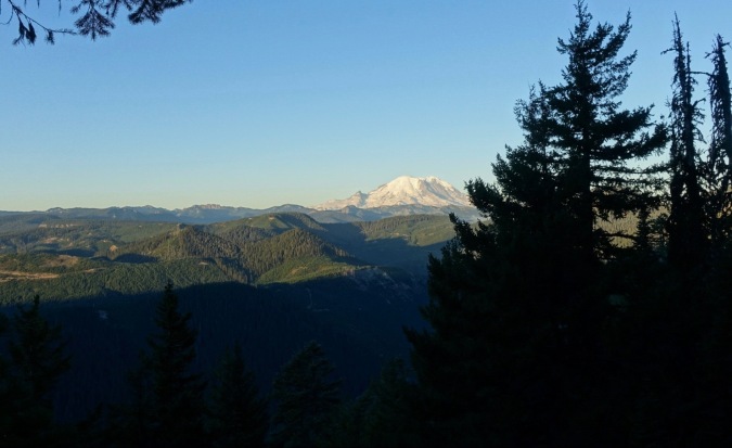
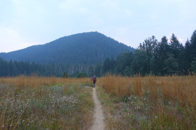
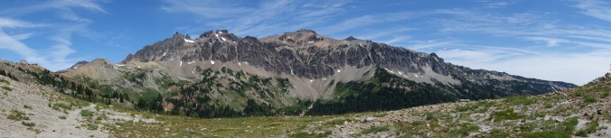
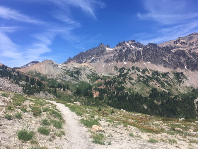
The trail was relatively flat this morning, with a couple sub-thousand foot climbs thrown in for good measure.  The big treat for the morning was the second climb, which finally had breaks in the tree line and good visibility.  What a view!  At first just if the surrounding mountains and ridge lines, bit then Mt. Adams started to gradually appear as I climbed higher.  Finally we got to see it in all its glory!  Just to add to the visual treat, the bushes surrounding the trail were full of berries, so between stopping to soak in the views and stopping to pick the berries there were lots of excuses to stop during the climb!

DSC04026

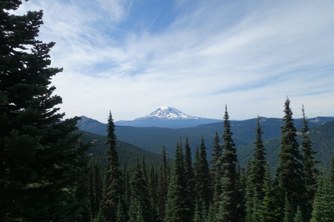
Finally a good look at Mt. Adams

DSC04028

We also ran into a couple of nobos that we’d seen a bunch in Oregon (including Twix), except this time they were heading south due to logistics.  Given that we’ll be heading back to Oregon soon for the eclipse, it might have made sense for us to do the same… but I really wanted to keep up my nobo status so northward we hike!

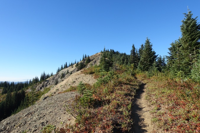
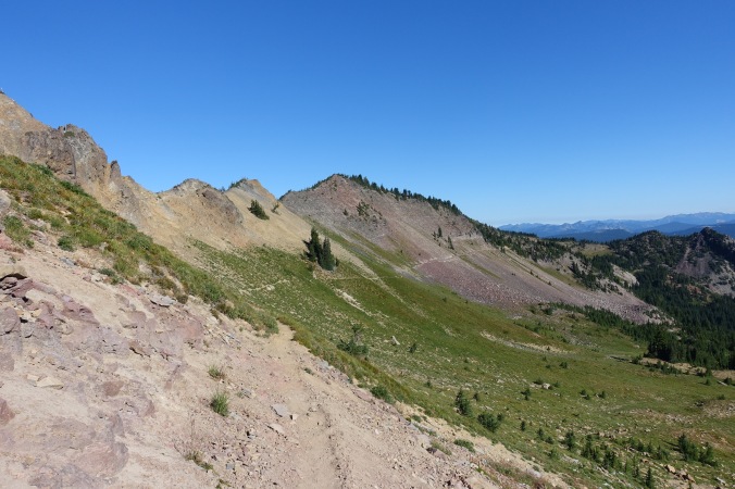
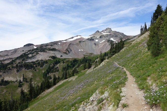
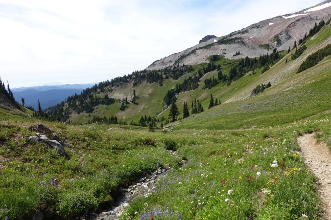
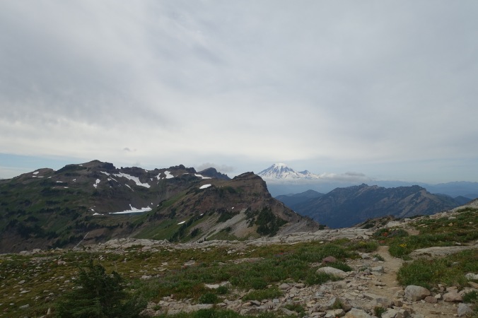
After lunch, the day continued to get more and more spectacular.  We passed over a knob and BAM!  The views were breathtaking.  So this is the Washington that people talk about.  Everywhere we turned, the views seemed to get better and better.

DSC04030DSC04032DSC04033

This section of the trail was popular with weekend backpackers (deservedly so) and we noticed that prime camping spots were occupied as early as noon!  Unfortunately (or fortunately?), we had to keep moving.  I stopped to chat for a bit with a ranger.  She didn’t check my PCT permit (hasn’t been checked yet!), but did remind us that we still needed to fill out the self-registration permits as we enter each park in Washington since they are used for search and rescue purposes.

DSC04034DSC04035

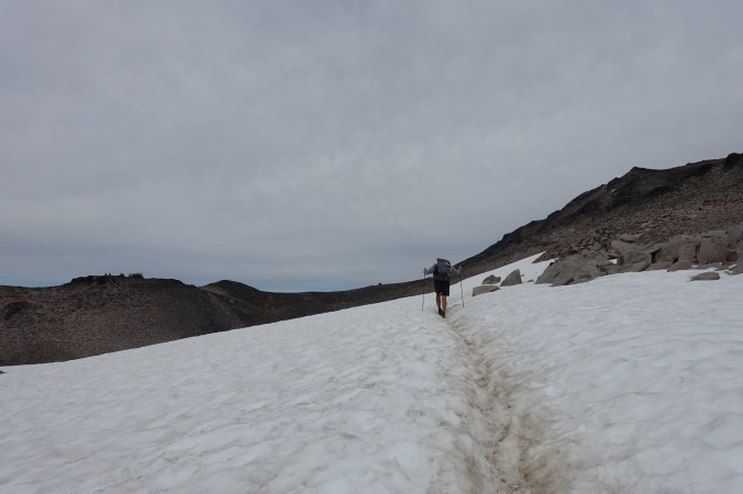
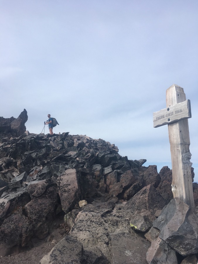
Our big goal for the afternoon was to make it over the Knife’s Edge and to a lower camp site before dark.  I’ve read about the Knife’s Edge in other PCT blogs, but was a little uncertain as to where it was in Washington (for some reason I thought that it was further north).  It was only last night that I realized that we’d be hitting that section today!  Luckily, the skies were clear as we approached the turn off for the alternate section of trail.  But first, some snow!

img_1666

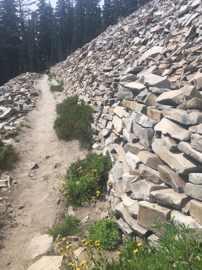
I can’t even begin to imagine how much work went into building this retaining wall.

DSC04036DSC04037DSC04038

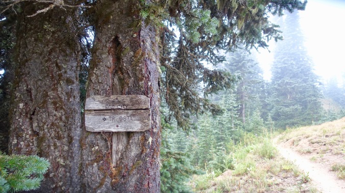
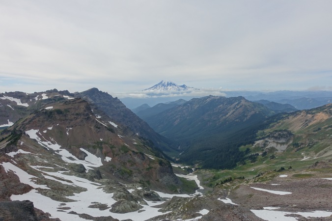
My understanding is that the alternate trail for the Knife’s Edge is basically the old PCT, but that it’s not equestrian friendly (it’s not).  The funny thing was that by taking the alternate, we actually avoided having to traverse a large section of snow.  The trail initially climbed up on a rocky set of switchbacks, and then we descended along the Knife’s Edge itself — a section of trail set precariously atop the rocky ridge line.  I’m not particularly scared of heights, but the rocky trail and steep drop off definitely slowed me down.  The views were amazing though!

DSC04041DSC04045

As we (slowly) descended, the clouds started to move in and we soon found ourselves completely enveloped in the fog.  It was an amazing sight… at first.
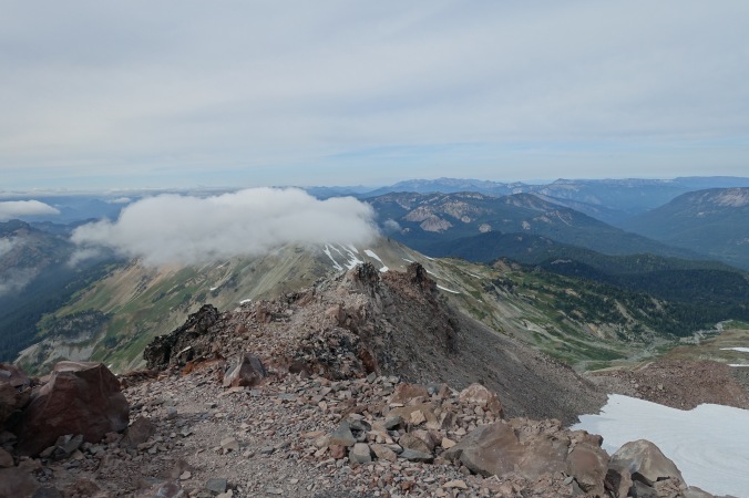
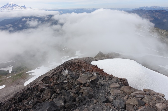
DSC04047DSC04048

DSC04051

Clouds rolling in.

DSC04052

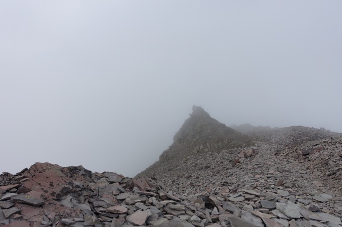
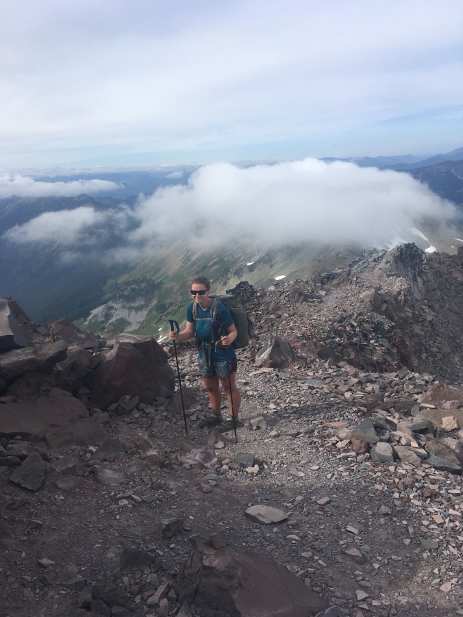
Umm… where did my views go?

The spectacular quickly turned to the somewhat scary.  The visibility dropped and the wind picked up.  I was soon cold (even with my rain jacket on) and battling the wind to stay on the steep, rocky trail.  My goal quickly became to get to a lower elevation as soon as possible.  The problem was, that with the steep trail (that kept going up instead of down) and uncertain footing, the descent did not go as quickly as I would have liked.  I’m really glad that we didn’t hit the Knife’s Edge any later in the day (we hit the alternate turnoff at 4:15) because it ended up taking much longer to descend than I had anticipated.  I can’t even imagine how miserable (and potentially dangerous) this section would have been in yesterday’s storm.  The sobos that we spoke with this morning reported having extreme difficultly even finding the trail along this section.  One young woman said that she’d had to set up her tent to wait out to storm because she’d gotten too cold and couldn’t find the trail (I have no idea where this could have been since we saw few places that a tent could have been set up)!

DSC04054

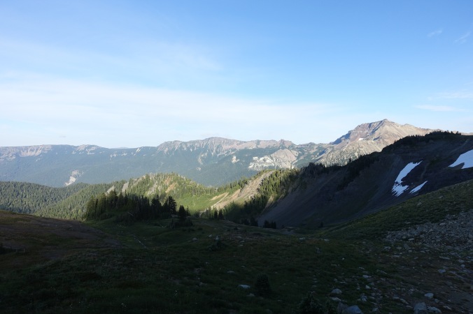
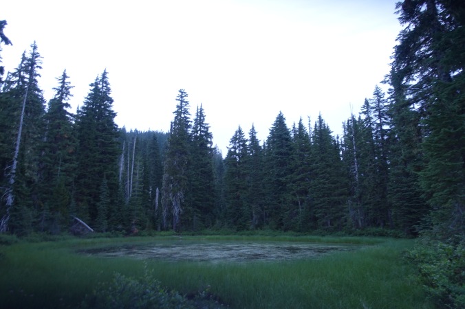
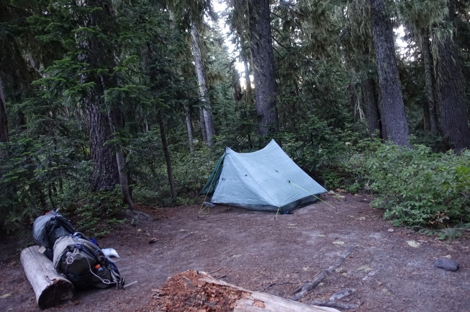
After crossing a knob and getting to a lower elevation, we found that it was actually a lovely evening if you weren’t stuck in a bunch of clouds.  Nonetheless, even though it was after 6:30 we passed the first potential camping area in favor of getting down even further.  We finally settled on camping near Lake Lutz, which I’d expected to already be full of campers by the time we arrived given that it’s a water source.  However, the first camp spot I found was vacant, so I called it a win and grabbed it.  I can’t tell if anyone else is camped on the other side of the lake, but it’s pretty quiet and bug-free enough to eat dinner outside the tent! 

DSC04055

Somehow I didn’t manage to get any pictures of the lake (more of a pond…).

Despite a somewhat sketchy and miserable end to the day, I have to say that today was one of my favorite days on the trail.  The scenery was magnificent!  The reputation of Goat Rocks Wilderness and the Knife’s Edge is well deserved!

Current ailments:

Elizabeth: sort left shoulder

Michael: sore left big toe

Day 118: From Hot to Cold

August 13, 2017

Total daily miles: 26.7 miles

Total PCT miles: 1846.4

Start: mile 2226.5

End: mile 2253.3

Total elevation gain/loss: 4163.4/2944.9 ft

We woke up this morning to the sound of a light rain.  I’d been expecting some rain on this section, but I had hoped that the light rain a day ago was going to be it.  Since the rain didn’t sound heavy and we weren’t sure how long it would last, we decided to just suck it up and get hiking.  We were camped underneath a tree last night and it looks like if we’d just camped a few feet over we might have stayed completely dry!  As it was, we were able to get packed up without too much of our stuff getting wet.

DSC03999

The wet underbrush created a car-wash effect. It wasn’t long before my legs (and therefore my shoes) were wet.

DSC04000

Continue reading

Day 117: Washington Trail Magic

August 12, 2017

Total daily miles: 28.3 miles

Total PCT miles: 1819.6

Start:  Green Lake (mile 2198.1)

End: mile 2226.5

Total elevation gain/loss: 4021.7/4432.1 ft

Just as I was falling asleep last night, I was woken by the light pitter patter of rain droplets.  Then flashes of light and the rumble of thunder.  I quickly closed my vestibule and went back to sleep.  I was pleasantly surprised to wake up this morning to find that the rain was over and my tent was nice and dry.  Yay for minor miracles!

DSC03985

Green Lake first thing in the morning.

DSC03986

Continue reading

Day 116: Green Tunnel

August 11, 2017

Total daily miles: 24 miles

Total PCT miles: 1791.2

Start:  Trout Creek (mile 2174.1)

End: Green Lake (mile 2198.1)

Total elevation gain/loss: 5405.5/2339.6ft

I slept great last night with the sound of the creek in the background and the best part is that we woke up to no condensation!  We set off this morning at the same exact time as Sam and Tam.  It was almost as though we had planned it!  I chatted with them for a bit and then let them pass ahead as I stopped to take some photos.

DSC03968DSC03969DSC03970

Continue reading

Day 115: Sweating My Way Into Washington

August 10, 2017

Total daily miles: 22.5 miles (19.4 PCT + 3.1 logging alternate)

Total PCT miles: 1767.2

Start: mile 2152.7

End: Trout Creek (mile 2174.1)

Total elevation gain/loss: 4577.4/5390.7 ft

My wish did not come true and it stayed warm all night last night.  It was clear that it would be a hot day today before I’d even emerged from my tent.  I was sweating up a storm within five minutes of setting out this morning.  We started out with a big climb, but couldn’t get Guthooks working on my phone to tell me how close I was to the top.

DSC03960

I think this was supposed to be an old railroad housing, but now it just looks like a lot of old logs in a line.

DSC03961DSC03962 Continue reading

Day 114: Our First Taste of Washington

August 9, 2017

Total daily miles: 8.3 miles

Total PCT miles: 1745.8

Start: Cascade Locks (mile 2144.4)

End: mile 2152.7

Total elevation gain/loss: 2536.1/601.7 ft

I woke with a start this morning, afraid that I’d slept in until 11am.  Is if.  It was only 6:45.  What I would give to actually sleep in one of these days.

We spent the morning hunkered down in our motel room — loading blog posts, sorting through our gear in preparation for sending a box of extra gear home, and figuring out our plans for the upcoming eclipse (we’re planning to return to Oregon to meet Michael’s parents).  Basically, we didn’t leave until check out time at noon, and even then we ended up needing some extra time in our room to sort things out.  Where does town time go?

DSC03941

I married a nerd.

DSC03942

We’re back for a junior cone!

Continue reading